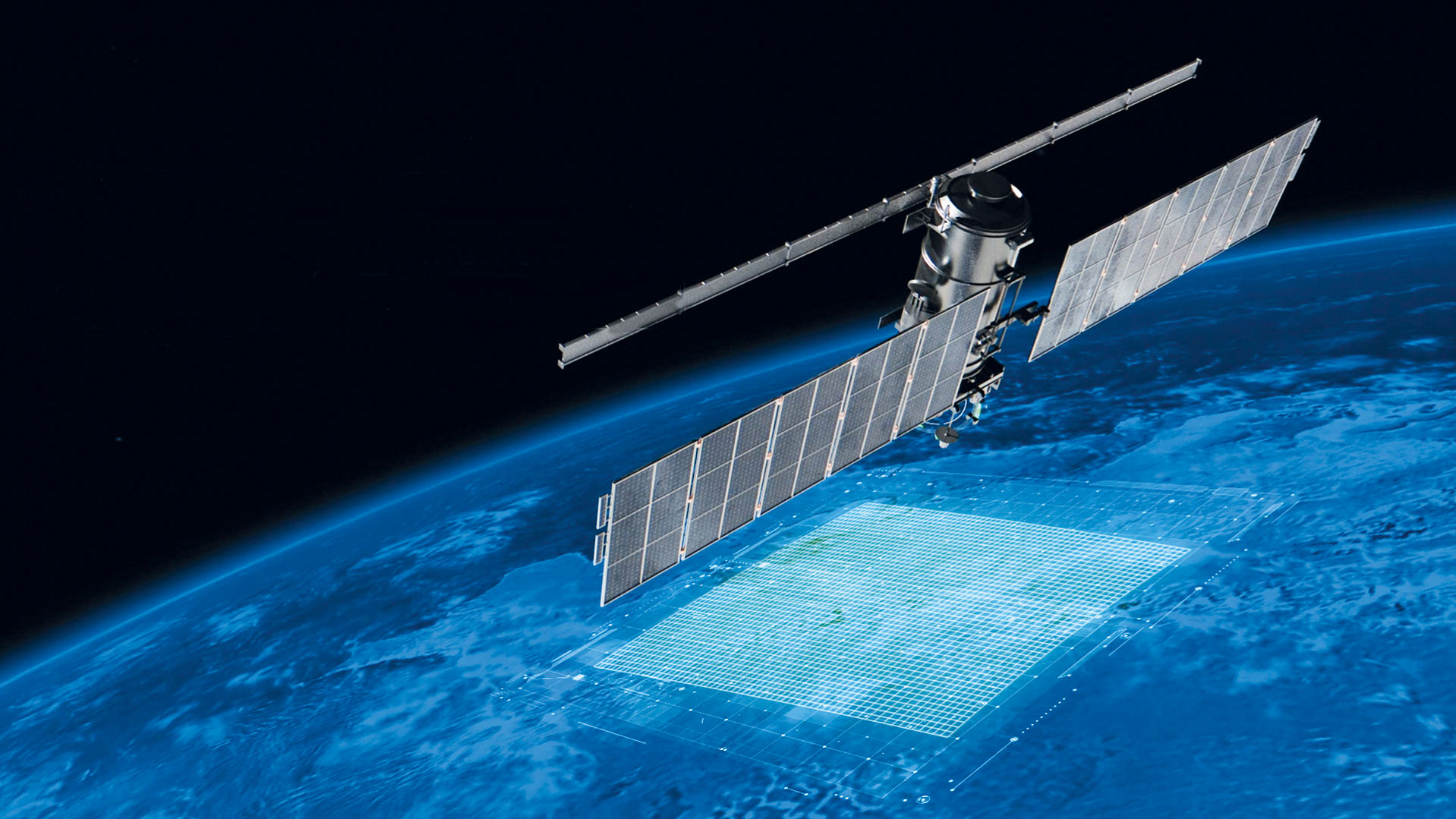
SEVERYANIN-M radar aboard METEOR-M spacecraft

On September 17, 2009, the METEOR-M No. 1, the first spacecraft, being a part of the orbital constituent of the METEOR-3M Space Complex (the Complex) for Hydrometeorological and Oceanographic support was launched into orbit from the Baikonur cosmodrome by a Soyuz-2.1b carrier rocket with a Fregat upper stage. The Complex was designed for acquisition of ERS data for the benefit of operational meteorology, hydrology, agrometeorology, monitoring of climate changes and environment, monitoring of natural and man-made emergencies, provision of support in conducting heliogeophysical research, studying the state of the atmosphere.
The launch on September 17, 2009, initiated the reconstruction of the Russian meteorological orbital constellation. For the first time in a long time, the METEOR-M No.1 ERS satellite became the first next-generation hydrometeorological one, which was not inferior in its technical characteristics to its Western counterparts. This ensured strategic independence for Russia from foreign meteorological satellites.
Fifteen years ago, the SEVERYANIN-M onboard synthetic aperture radar (SAR), designed by RIPI engineers, took up its orbital duty as a constituent of the METEOR-M No.1 ERS satellite.
Aleksander Gyune, Senior Researcher from the Radar Systems Department recalled:
- For our institute, this work began when, in 1999, VNIIEM, a spacecraft manufacturer, proposed us to design a small-sized wide-range radar for a new series of meteorological satellites METEOR-M. The SEVERYANIN-M provided monitoring of ice and snow covers, the state of hydrological objects, as well as land surface and vegetation in the X-band. It had two operating modes with a horizontal spatial resolution of 500 m and 1000 m consequently and a swath width of 600 km. Hundreds of radar activations were conducted, while the SEVERYANIN-M as part of the METEOR-M spacecraft was in operation, which made it possible to take and send images of vast territories of our planet.
Aleksander Kovalenko, Head of the Radar Systems Department, one of the designers of the SAR and the author of the radar name idea, shared his memories with our journalist:
- The choice of the name for the spaceborne radar complex was influenced by the geography of the RIPI location — the north of our capital, — and the abundance of toponyms reflecting this location. It is enough to mention as examples Severyaninsky overhead road, bridge, passway, Severyanin platform, there is even still a department store with such a name. Many engineers, developers, programmers liked the idea once it came to my mind to call our radar complex this way. At the same time, the name "Severyanin" itself absolutely right reflected the purpose of the Complex — radar survey of high-latitude Arctic territories. As a result, the name stuck and it replaced the former radar working name. For all of us, the SEVERYANIN-M was the first experience of building a spaceborne synthetic aperture radar.
The world space science and technology consider such multi-purpose remote sensing spacecraft, providing multisensory analysis, to be the most complicated devices. In realizing this sophisticated project, the core group of developers emerged, who gained invaluable experience from mutual interaction with each other and other related organizations. Many of the organizational and technical achievements, made at that time proved to be extremely useful for our future projects in the field of space-based synthetic aperture radars.
Both of our SEVERYANINs exceeded their planned mission life as the constituents of spacecraft: instead of scheduled three years, they operated for seven and five years respectively. Ten years ago, just in July 2014, the METEOR-M No. 2 hydrometeorological satellite with the SEVERYANIN-M radar aboard was launched into orbit. This radar was also manufactured at our Institute, but unlike the first one, it provided an observation mode with an increased radiometric sensitivity, thus allowed enhancing the distinguishability of ice in its age, expressed in different thicknesses and different colors.
This information is important for glaciologists and other specialists working in the Arctic zone. Although both of our radars completed the operation a decade and a half ago, the industry experts still rate the SEVERYANIN-M series radars as a very worthy project. Their particular significance lies in the fact that the spacecraft for which they were designed and manufactured went into serial production and till present they continue functioning effectively. The data collected from the METEOR-M No.1 became the basis for global and regional weather analysis and forecasting; for studying the state of the global ocean and regional seas; analyzing airline flight conditions; monitoring climate, heliogeophysical state in near-Earth space, state of the ionosphere and the Earth's magnetic field, as well as managing emergency environmental situations.
The main users of this information are: the Federal Service for Hydrometeorology and Environmental Monitoring (Roshydromet), the Ministry of Natural Resources and Environment of the Russian Federation, Roscosmos, Ministry of Emergency Situations of Russia, Federal Forestry Agency, executive bodies of the constituent entities of the Russian Federation and others.
Prepared based on the materials from JSC Russian Space Systems
and JSC VNIIEM Corporation Press Services