New Roscosmos Geoportal
A new version of the Roscosmos Geoportal, developed by the RIPI specialists, has been launched at https://next.gptl.ru.
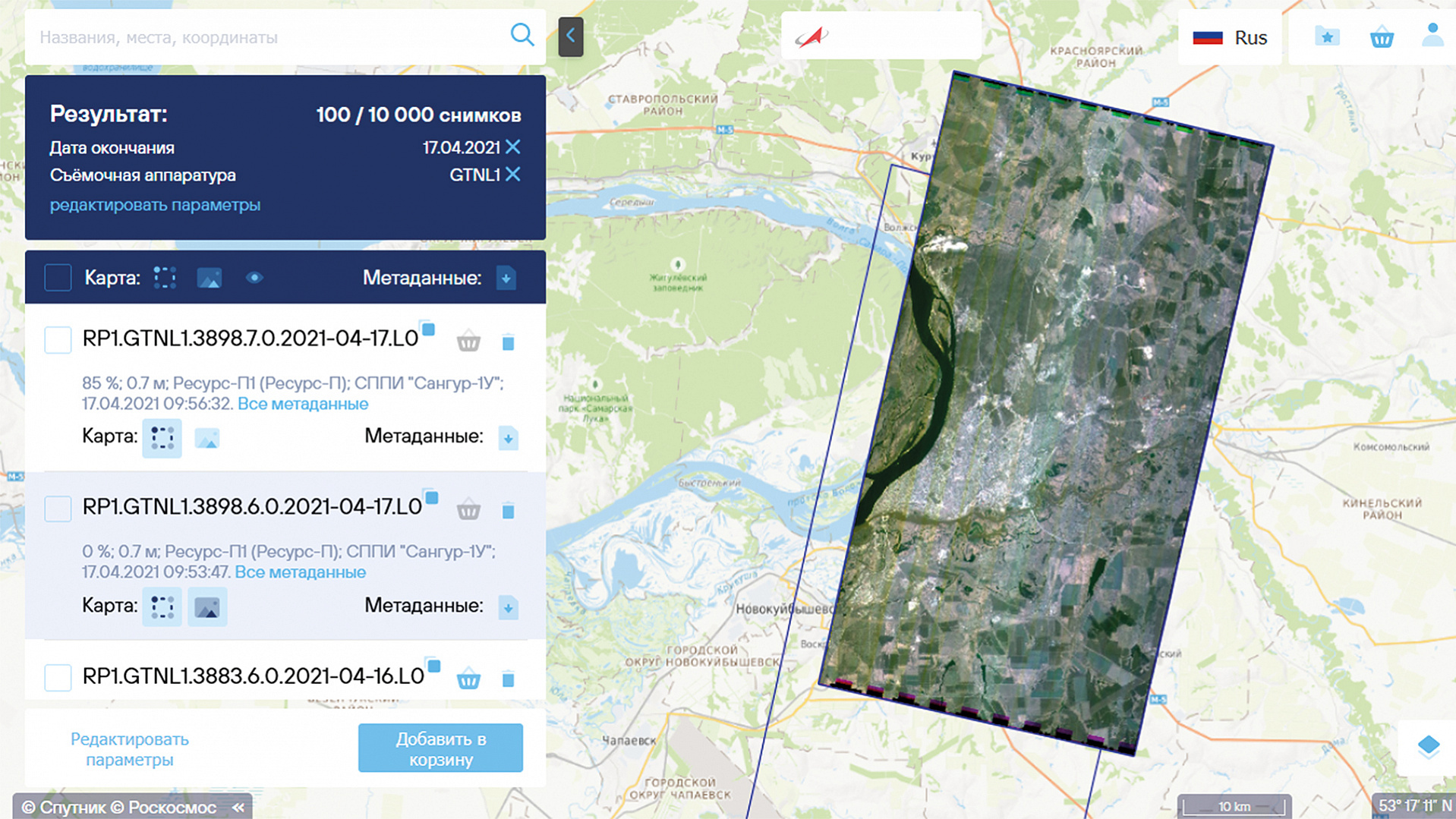
The new Roscosmos Geoportal offers services (in electronic form) for ordering satellite imagery from the Federal ERS data fund. This fund gathers data, obtained from the Russian ERS satellites. Currently, the archive is constantly replenished and updated by the high- and medium-resolution satellite imagery, acquired from the multispectral imaging cameras installed aboard the satellites of “Resurs-P”, “Kanopus-V” and “Meteor-M” series.
An important benefit of the new Geoportal for individuals and commercial entities has been the possibility to have full-scale access to the base of Russian high-resolution ERS space-derived images. This service is provided to this type of consumers for a fee, in contrast to free access to images with less resolution, received from Meteor-M satellites. The state entities have free access to all categories of satellite imagery.
When searching and ordering one or more images, an intuitive interface allows indicating the parameters of interest for the requested product. The user can select the type of product: panchromatic (black-and-white single-channel image with the highest possible resolution); multispectral (multichannel image with lower resolution); a set of two previous products or pan-sharpened image (color image with resolution of panchromatic image). The user indicates the part of image desired: the whole picture; cropped by the search area; cropped by the fragment specified. In the final stage of ordering the user can specify whether to transform the image into a cartographic projection (Level 2 processing) or to accompany the image with georeference data in the form of RPC (Level 1 processing).
To execute an order, the ERS data (images) are extracted from the archives, processed in accordance with the specified parameters, and become available for the user in the new Roscosmos Geoportal Personal Account within a few hours after ordering.
Using the Personal Account, the user can view highly-detailed images on the map online; download files to his computer, and also copy the provided link to ensure the introduction of images into a geographic information system or to user’s app without having to download files. Ready products are stored for 21 days.
In developing the new Geoportal, as well as in the course of further modernization of the Central Geodata Bank and the Computing Resources Complex, our specialists mastered and applied a number of cloud technologies, which enabled interaction with the users at a level that suits the most advanced technologies, capabilities and services.
A single computer cluster is used in the Computing Resources Complex for large-scale computing and storage “in cloud”. It runs the Central Geodata Bank software, which provides web services for searching across a catalog; viewing images and seamless mosaic coverings in full resolution online.
Depending on the number of incoming requests, the cloud computing environment Kubernetes, dynamically manages a certain number of operating instances of certain programs from the Central Geodata Bank. A cloud data warehouse, applying COG format (Cloud-optimized GeoTIFF) and AWS S3 access protocol, provides high data exchange rate for users and programs of the Central Geodata Bank.
Software requirements specification (SRS) of the ERS data fund are published in the new Roscosmos Geoportal. Using this SRS, the Digital Earth information system is being developed; a set of sectoral information services (https://dgearth.ru/) has been built; currently, the work is carried out to ensure interaction between the IGDERSIS (Integrated Geographically-Distributed ERS Information System) and Management State Automated Information System, the National Data Management System and other state information systems.
Ovnan Tokhiyan, head of division, JSC RIPI, gave general assessment of the new version of the Roscosmos Geoportal and assessed its prospects for the years to come:
Roscosmos Geoportal has reached a new level in providing customer services, including the commercial ones. I hope, that successful mastering and application of cloud technologies and the latest software development technologies will increase the competitiveness of our Institute on the information technology market.
RIPI Press Service