Software suite operational visualization of geodata
PURPOSE of the COMPLEX
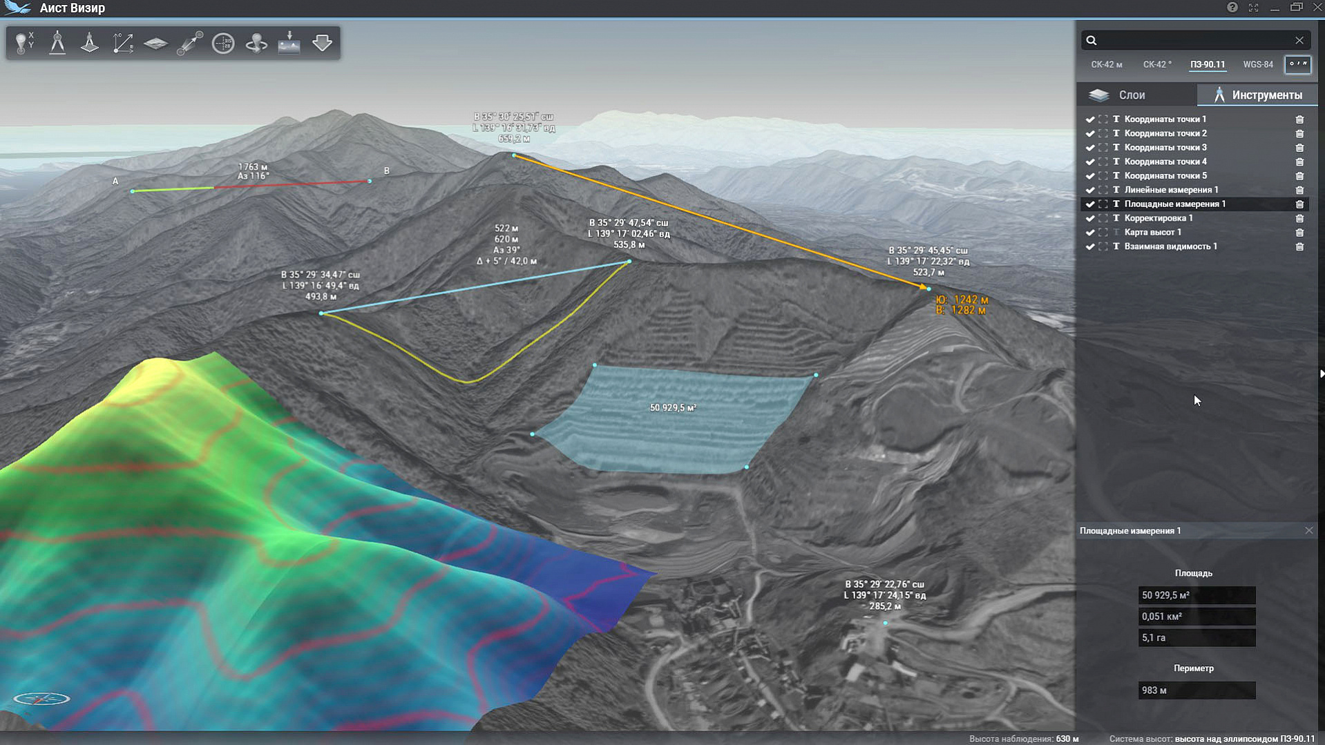
This software suite is designed for operational visualization of various geospatial information in near real-time, as well as to solve a number of basic computational tasks based on it.
SPECIFICATIONS of the COMPLEX
This software suite ensures:
- prompt solution of visualization tasks for heterogeneous geospatial information in planned and three-dimensional modes without connecting to the Internet
- determining spatial coordinates of any point
- conducting terrain measurements, taking into account and without taking into account the form of relief
- search by coordinates and names
- calculating visibility from a point
- exporting raster data to a file for printing or for use in third-party software